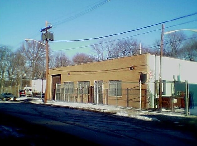
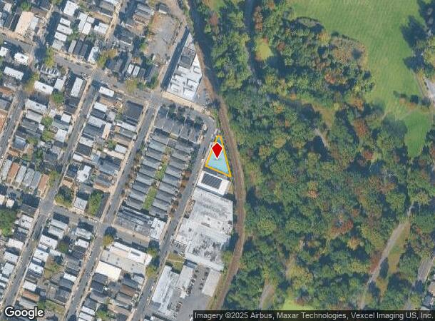
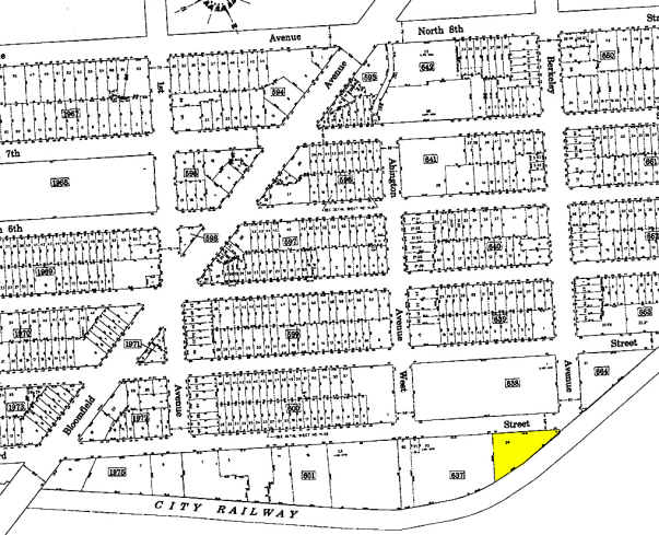
Property Record
677 3Rd St, Newark, NJ 07107
NEARBY LISTINGS FOR SALE OR LEASE
Property Detail
677 3Rd St
Newark, NJ-PA
8315 SF
14-00637-0000-00024-02
Essex
Shipyard
New Jersey
X
24.2
34003C0245H
0.19 AC
2023
West Newark
2025
Northern New Jersey
000800
DEMOGRAPHICS near 677 3Rd St
1 Mile
3 Mile
5 Mile
2024 Total Population
63,771
389,827
745,778
2029 Population
61,284
377,810
724,414
Pop Growth 2024-2029
(3.90%)
(3.08%)
(2.86%)
Average Age
37
38
38
2024 Total Households
22,916
146,573
276,609
HH Growth 2024-2029
(4.00%)
(3.08%)
(2.95%)
Median Household Inc
$44,304
$56,932
$61,655
Avg Household Size
2.70
2.50
2.60
2024 Avg HH Vehicles
1.00
1.00
1.00
Median Home Value
$327,732
$341,755
$386,187
Median Year Built
1958
1960
1957
Nearby Places
Map Layers
Map Styles
 Street
 Aerial
- Restaurants
- Banks
- Shops
- Fitness
- Groceries
PUBLIC TRANSPORTATION
TRANSIT/SUBWAY
Davenport Avenue (Grove Street - Newark Penn Station - Newark Light Rail (Newark Light Rail))
DRIVE
WALK
Distance
Davenport Avenue (Grove Street - Newark Penn Station - Newark Light Rail (Newark Light Rail))
2 min
6 min
0.3 mi
Bloomfield Avenue (Grove Street - Newark Penn Station - Newark Light Rail (Newark Light Rail))
DRIVE
WALK
Distance
Bloomfield Avenue (Grove Street - Newark Penn Station - Newark Light Rail (Newark Light Rail))
1 min
7 min
0.4 mi
Branch Brook Park (Grove Street - Newark Penn Station - Newark Light Rail (Newark Light Rail))
DRIVE
WALK
Distance
Branch Brook Park (Grove Street - Newark Penn Station - Newark Light Rail (Newark Light Rail))
3 min
19 min
1.0 mi
Park Avenue (Grove Street - Newark Penn Station - Newark Light Rail (Newark Light Rail))
DRIVE
WALK
Distance
Park Avenue (Grove Street - Newark Penn Station - Newark Light Rail (Newark Light Rail))
3 min
19 min
1.0 mi
Silver Lake (Grove Street - Newark Penn Station - Newark Light Rail (Newark Light Rail))
DRIVE
WALK
Distance
Silver Lake (Grove Street - Newark Penn Station - Newark Light Rail (Newark Light Rail))
4 min
19 min
1.0 mi
COMMUTER RAIL
Watsessing Avenue (Montclair-Boonton Line - NJ Transit Commuter Rail (NJ Transit))
DRIVE
WALK
Distance
Watsessing Avenue (Montclair-Boonton Line - NJ Transit Commuter Rail (NJ Transit))
6 min
1.8 mi
Newark Broad Street (Montclair-Boonton Line - NJ Transit Commuter Rail (NJ Transit), Morris & Essex Gladstone Branch - NJ Transit Commuter Rail (NJ Transit), Morris & Essex Morristown Line - NJ Transit Commuter Rail (NJ Transit))
DRIVE
WALK
Distance
Newark Broad Street (Montclair-Boonton Line - NJ Transit Commuter Rail (NJ Transit), Morris & Essex Gladstone Branch - NJ Transit Commuter Rail (NJ Transit), Morris & Essex Morristown Line - NJ Transit Commuter Rail (NJ Transit))
5 min
2.0 mi
AIRPORT
Newark Liberty International
DRIVE
WALK
Distance
Newark Liberty International
14 min
8.0 mi
LaGuardia
DRIVE
WALK
Distance
LaGuardia
44 min
28.2 mi
John F Kennedy International
DRIVE
WALK
Distance
John F Kennedy International
53 min
31.0 mi
Freight Ports
Maher Terminal
DRIVE
WALK
Distance
Maher Terminal
18 min
8.4 mi
Nearby Properties
Address
Land Use
TOTAL SIZE
Lot Size
Zoning
Address
Land Use
TOTAL SIZE
Lot Size
Zoning
0.57 AC
Address
Land Use
TOTAL SIZE
Lot Size
Zoning
0.45 AC
Address
Land Use
TOTAL SIZE
Lot Size
Zoning
31.86 AC
Address
Land Use
TOTAL SIZE
Lot Size
Zoning
Address
Land Use
TOTAL SIZE
Lot Size
Zoning
877 SF
7.25 AC
Address
Land Use
TOTAL SIZE
Lot Size
Zoning
3,956 SF
250 AC
C2
Address
Land Use
TOTAL SIZE
Lot Size
Zoning
683 SF
9.59 AC
Address
Land Use
TOTAL SIZE
Lot Size
Zoning
2,500 SF
43.35 AC
Address
Land Use
TOTAL SIZE
Lot Size
Zoning
2.01 AC
Address
Land Use
TOTAL SIZE
Lot Size
Zoning
3.42 AC
Address
Land Use
TOTAL SIZE
Lot Size
Zoning
320 SF
1.25 AC
Address
Land Use
TOTAL SIZE
Lot Size
Zoning
9.77 AC
Address
Land Use
TOTAL SIZE
Lot Size
Zoning
877 SF
0.91 AC
Address
Land Use
TOTAL SIZE
Lot Size
Zoning
1.64 AC
Address
Land Use
TOTAL SIZE
Lot Size
Zoning
Address
Land Use
TOTAL SIZE
Lot Size
Zoning
1.63 AC
Address
Land Use
TOTAL SIZE
Lot Size
Zoning
17.97 AC
Address
Land Use
TOTAL SIZE
Lot Size
Zoning
Address
Land Use
TOTAL SIZE
Lot Size
Zoning
2.79 AC
Address
Land Use
TOTAL SIZE
Lot Size
Zoning
0.13 AC
Address
Land Use
TOTAL SIZE
Lot Size
Zoning
1,264 SF
3.20 AC
Address
Land Use
TOTAL SIZE
Lot Size
Zoning
Address
Land Use
TOTAL SIZE
Lot Size
Zoning
0.06 AC
Address
Land Use
TOTAL SIZE
Lot Size
Zoning
0.09 AC
Address
Land Use
TOTAL SIZE
Lot Size
Zoning
877 SF
1.95 AC
Address
Land Use
TOTAL SIZE
Lot Size
Zoning
877 SF
1.35 AC
Address
Land Use
TOTAL SIZE
Lot Size
Zoning
16,084 SF
7.23 AC
Address
Land Use
TOTAL SIZE
Lot Size
Zoning
12.54 AC
OPRP
Address
Land Use
TOTAL SIZE
Lot Size
Zoning
683 SF
0.79 AC
Address
Land Use
TOTAL SIZE
Lot Size
Zoning
3.31 AC
The World's #1 Commercial Real Estate Marketplace
Connect with us
© 2025 CoStar Group
The information above has been obtained from sources believed reliable. While we do not doubt its accuracy we have not verified it and make no guarantee, warranty or representation about it. It is your responsibility to independently confirm its accuracy and completeness. Any projections, opinions, assumptions, or estimates used are for example only and do not represent the current or future performance of the property. The value of this transaction to you depends on tax and other factors which should be evaluated by your tax, financial, and legal advisors. You and your advisors should conduct a careful, independent investigation of the property to determine to your satisfaction the suitability of the property for your needs.